Description
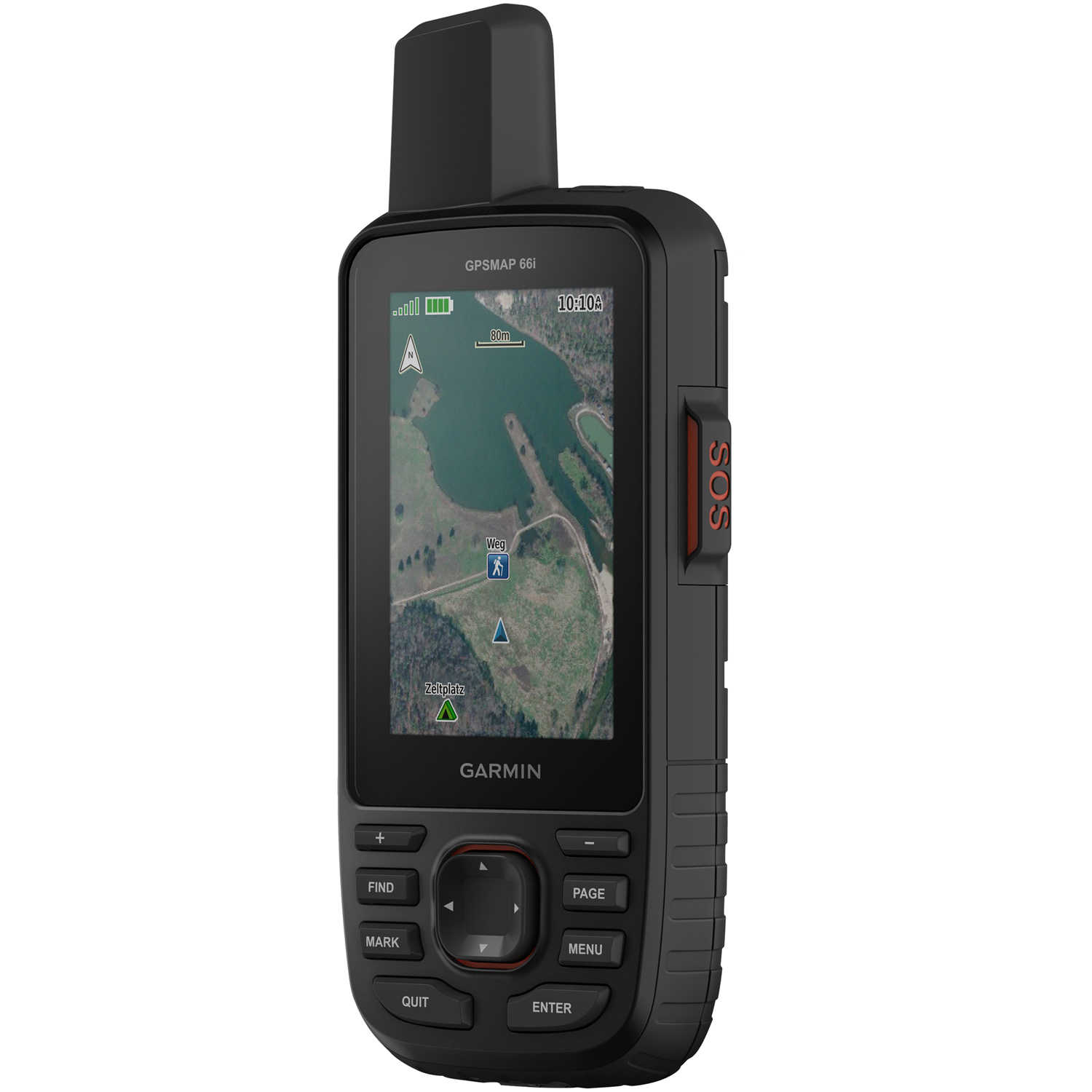
Garmin GPSMAP 66i
The GPSMAP 66i is a button-operated GPS handheld and satellite communicator that lets you trigger an interactive SOS to GEOS and enables two-way messaging and location tracking via the 100% global Iridium® satellite network. This premium, rugged handheld has a 3˝ color display and access to BirdsEye Satellite Imagery with direct-to-device downloads through Wi-Fi® wireless networking and preloaded TopoActive U.S. and Canada maps. It provides multiple Global Navigation Satellite Systems (GNSS) support to track your route in more challenging environments than GPS alone plus ABC (altimeter, barometer and compass) sensors. Wireless connectivity through Bluetooth® and ANT+® technologies provides Active Weather updates and compatibility with the Garmin Explore™ app for offline access to cloud-based route planning.
Warning: Cancer and Reproductive Harm P65Warnings.ca.gov
Have A Question?
Quick Specs
| Brand | Garmin |
| MPN | 010-02088-01 |
| UPC | 753759218737 |
| UNSPSC | 52161518 |
| Other |
Display size: 1.5˝W x 2.5˝H (3.8 x 6.3 cm); 3˝ diag (7.6 cm). Display resolution: 240 x 400 pixels. Physical dimensions: 2.6˝ x 6.4˝ x 1.4˝ (6.2 x 16.3 x 3.5 cm). Battery: Rechargeable internal lithium-ion. Interface: micro USB and NMEA 0183 compatible. Water rating: IPX7. Weight: 8.5 oz (241 g) with batteries. Display type: transflective color TFT.
High-sensitivity receiver: Yes. Maps & Navigation. Storage and Power Capacity: microSD™ card (not included). Basemap: Yes. Routes: 250. Track log: 20000 points, 250 saved gpx tracks, 300 saved fit activities. Waypoints/favorites/locations: 10000. Memory/History: 16 GB. Preloaded maps: yes (topographic). Ability to add maps: Yes.
|
Quick Specs
Options and Accessories
Have a question about this product?


